
Is your child interested in learning about the United States of America? If so, this resource list for the 50 States Unit Study Guide is perfect. Moreover, it integrates social studies, language arts, geography, and history into a comprehensive study of all 50 states.
With printables, worksheets, puzzles, activities, games, and coloring pages, your child will learn by applying the lessons in so many fun ways. Themed unit studies are great learning materials!
This approach is an immersive way of teaching your child the facts and characteristics of each of the states. Furthermore, booklists, crafts, and supplementary resources are provided for each state to enhance the learning experience.
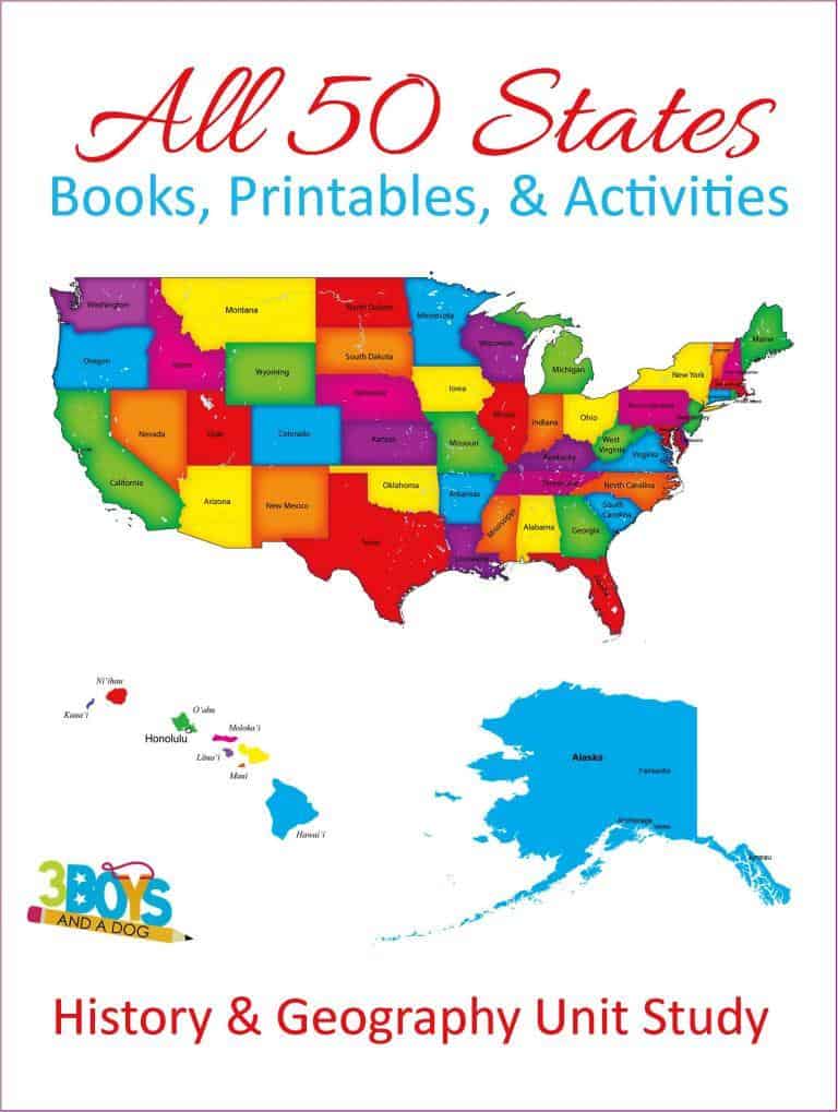
Welcome, teachers and homeschoolers! If you are looking for an engaging and comprehensive study guide to teach your students about the 50 states of the United States, you have come to the right place. Look no further!
This blog post will provide you with a wealth of resources, fun facts, and activities, making your state unit study both exciting and educational.
Whether you’re teaching 4th grade social studies or exploring state facts with students of all ages, this guide has everything you need.
We even have great resources for traveling the States with your children!
Using themed unit studies like this helps children grasp and understand concepts! And new this year is the Five Regions of the United States Worksheets!
Check out these 50 States Drawing and Writing Prompts as well! They’ll also love these State Flag Puzzles!
Comprehensive 50 State Study Guide for Homeschoolers
Studying the 50 states of the United States is a fundamental part of the social studies curriculum. Not only does it help students learn about geography, but it also provides valuable insights into each state’s history, culture, economy, and landmarks. Whether you’re teaching in a classroom or homeschooling, having a comprehensive state study guide ensures that students gain a well-rounded understanding of the country.
This US states study guide is designed to be an all-encompassing resource for homeschooling families, educators, and parents who want to make learning both engaging and interactive. It includes printables, activities, maps, and fun facts to help students study all 50 states in a structured yet enjoyable way.
From memorizing state capitals to exploring each state’s unique traditions and industries, this guide makes the process fun and hands-on. Whether you’re using flashcards, puzzles, or crafts, there are plenty of creative ways to reinforce learning.
By using this state study guide, students can develop a deeper appreciation for the diversity and uniqueness of each state while mastering essential geography skills. Whether you’re focusing on how to study the states efficiently or simply looking for an engaging way to study the US states, this guide provides everything needed to make the experience both educational and exciting!
- 50 States Unit Study – 700 Pages of Printables
- Are you looking to travel around the United States? Then, check out our list of Kid Friendly Places to Visit in the USA
- Learning States and Capitals with Family Game Night
- Check out these 12 Fun Roadside Attractions to See in the US!
- You will love these 14 Games to Learn the States for your children; additionally, you will all have a blast playing them together!
- Check out the Popular and Tasty Food from 50 States!
- Don’t miss out on these Educational and Fun USA Landmarks Flashcards!
- You’ll love this 50 States Printable Game!
All three of my children fell in love with this video about the states and their capitals. As a result, they can still sing the entire song to this day.
Please note, this is a very slow build. So, be sure to check back often as we add new resources regularly!
Fun Facts About the U.S. States
Did you know that North Carolina is known as the “Tar Heel State” or furthermore, that South Carolina is nicknamed the “Palmetto State?” These intriguing state nicknames are just the tip of the iceberg when it comes to interesting facts about the individual states in the United States.
Exploring fun facts about the U.S. states is a great way to engage students and spark their curiosity about the diverse characteristics of each state. Certainly, this method helps to make learning more enjoyable and memorable. Because of this engaging approach, let’s take a closer look at some fascinating facts about North Dakota and South Dakota:
North Dakota Fun Facts:
North Dakota is known as the “Peace Garden State.” Moreover, it is home to the International Peace Garden, a symbol of peace and cooperation between the United States and Canada. It is also famous for its vast prairies, which are a haven for wildlife like bison and elk.
South Dakota Fun Facts:
South Dakota is famous for Mount Rushmore, which features four U.S. presidents’ faces carved into the mountainside. This state is also home to the stunning Badlands National Park, known for its unique rock formations and fossil discoveries.
These are just a few examples of the interesting facts you’ll discover about each state as you explore the study guide. For instance, from state birds and flowers to historical landmarks and natural wonders, the U.S. states offer a wealth of fascinating information to capture the imagination of students.
So, whether it’s learning about the “Golden State” of California, the “Lone Star State” of Texas, or any other state in the U.S., delving into the fun facts about each state will not only broaden students’ knowledge but also instill a sense of pride and appreciation for the rich diversity found across the nation.
Alphabetical Order of the States
Learning the names of all 50 states can be challenging, especially for younger students. To make it easier, we provide resources that organize the states alphabetically. Consequently, this method helps students memorize the state names and serves as a useful tool for quizzes and tests.
Feel free to click the state name below to be taken directly to that state.
New York
North Carolina
North Dakota
Ohio
Oklahoma
Oregon
Pennsylvania
Rhode Island
South Carolina
You can always click the “Go to the List” text to be bounced back up to the above list.

Alabama
The state of Alabama lies in the southeastern United States. Furthermore, it borders Tennessee to the north and Georgia to the east. Additionally, Florida and the Gulf of Mexico lie to the south. Birmingham is the largest city in Alabama, followed by Montgomery.
Moreover, the state has a humid subtropical climate, with hot, humid summers and mild winters. Furthermore, Alabama is home to several major industries, including agriculture, forestry, mining, manufacturing, and tourism.
The state also boasts a rich cultural heritage that includes music, art, literature, and food.
Alabama’s diverse landscape and climate make it an ideal destination for outdoor recreation, and the state’s parks and forests offer opportunities for hiking, camping, fishing, and more.
14 Pages: Alabama State Unit Study
Free State Fact File Worksheets
Alabama Coloring and Writing Books
Super Fun Alabama Coloring and Writing Book
Free Printable Alabama Worksheets

Alaska
Alaska is the largest state in the US, covering an area of 663,268 square miles. It is also the least populous state, with a population of just over 730,000 people.
Despite its small population, Alaska is home to a diverse range of wildlife, including bears, moose, eagles, and caribou.
The state is also known for its stunning natural scenery, including mountains, forests, and glaciers. Travelers to Alaska can enjoy activities such as hiking, fishing, and dog sledding.
14 Pages: Alaska State Unit Study
Books about Alaska for Kids
Free State Fact File Worksheets
Alaska Coloring and Writing Book
Interesting Facts about Alaska for Kids
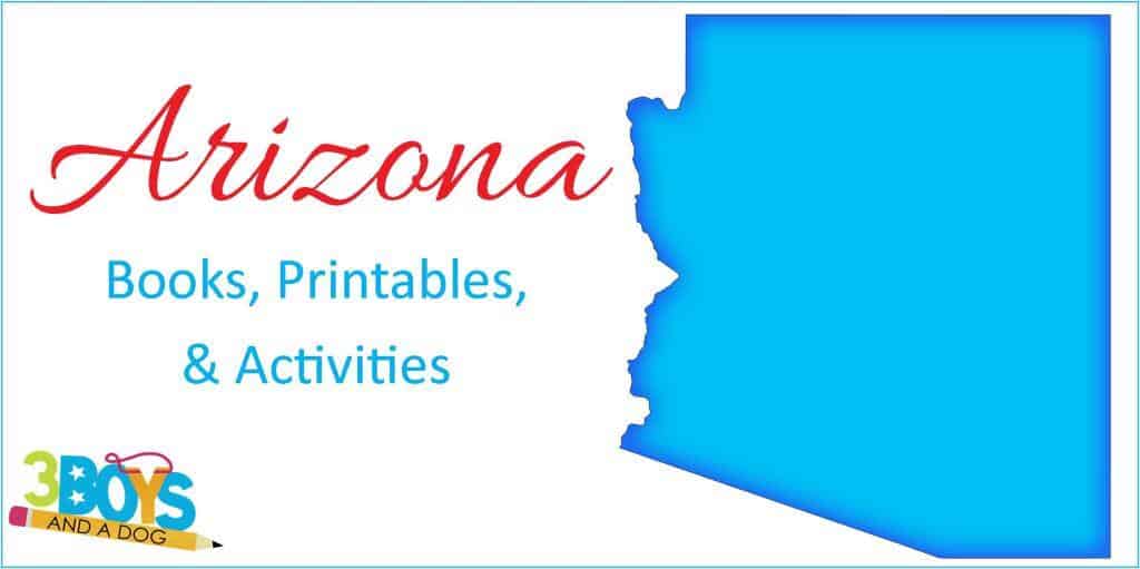
Arizona
Arizona lies in the southwestern United States. Because of its location, it borders California, Nevada, Utah, Colorado, and New Mexico.
The capital of Arizona is Phoenix, while Tucson is the largest city. The state joined the Union on February 14, 1912, becoming the 48th state.
The name “Arizona” comes from the Spanish word for “arid zone.” Due to its unique geography, Arizona is known for its desert climate and landscape.
The state has a diverse population with a significant Native American presence. Arizona is also home to the Grand Canyon, one of the seven natural wonders of the world.
Tourism is an important industry in Arizona, and the state is a popular destination for both domestic and international travelers.
14 Pages: Arizona State Unit Study
Books about Arizona for Kids
Free State Fact File Worksheets
Interesting Facts about Arizona (for kids)
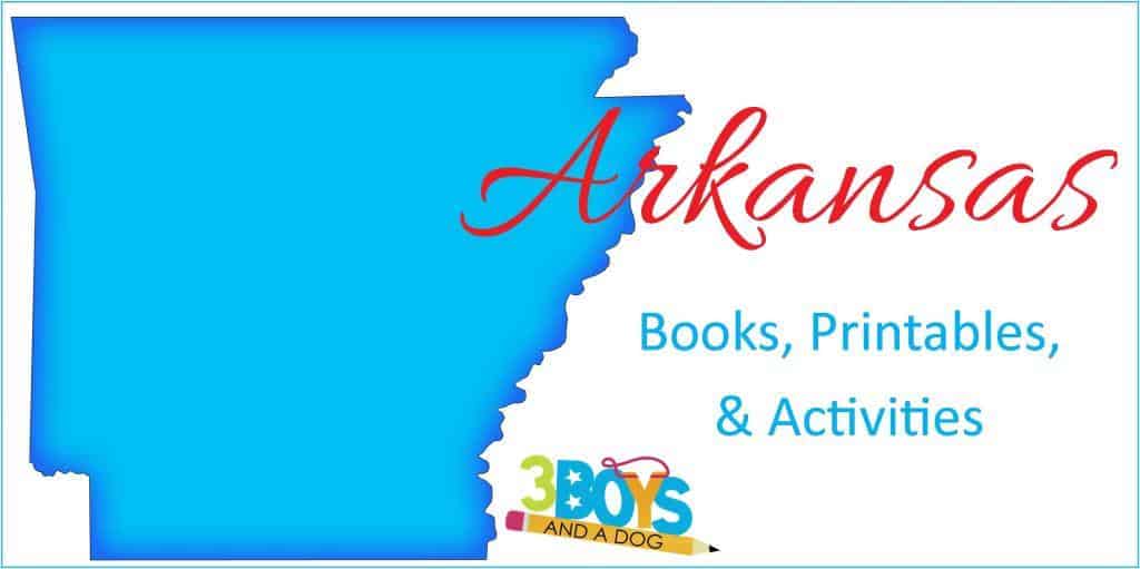
Arkansas
The state’s name comes from the French name for the Quapaw people. In addition, this highlights the cultural influence of French explorers in the region.
Moreover, Arkansas borders six states: Missouri to the north, Tennessee and Mississippi to the east, Louisiana to the south, Texas to the southwest, and Oklahoma to the west.
The capital and largest city is Little Rock, which is located in the central part of the state. Additionally, Arkansas covers an area of 113,733 square miles (295,356 square kilometers) and has a population of 3 million people.
Furthermore, the state’s economy is based on agriculture, manufacturing, forestry, and tourism.
Finally, some of the most popular tourist destinations in Arkansas include Hot Springs National Park, Eureka Springs, and Crater of Diamonds State Park.
14 Pages: Arkansas State Unit Study
Books about Arkansas for Kids
Free State Fact File Worksheets
Arkansas Coloring and Writing Book
5 Interesting Facts about Arkansas

California
California is a state located on the western coast of the United States. Specifically, it is bordered by Oregon to the north, Nevada to the east, and Arizona to the southeast. Additionally, the Pacific Ocean lies to the west. Los Angeles is the largest city in California, followed by San Diego and San Jose.
Moreover, the state has a diverse climate, ranging from the Mediterranean along the coast to the desert in the interior. Furthermore, California’s economy is one of the largest in the world, driven by industries such as technology, entertainment, agriculture, and tourism.
The state is also known for its rich cultural heritage, which includes film, music, art, and cuisine.
California’s varied landscape, featuring beaches, mountains, and forests, makes it an ideal destination for outdoor recreation. Additionally, the state’s parks and natural areas offer opportunities for hiking, surfing, skiing, and more.
14 Pages: California State Unit Study
Books about California for Kids
California Crafts for Children
Free California State Fact File Worksheets
California Coloring and Writing Book

Colorado
Colorado is a state located in the western United States. Specifically, it is bordered by Wyoming to the north, Nebraska to the northeast, Kansas to the east, Oklahoma to the southeast, New Mexico to the south, Utah to the west, and touches Arizona at the southwest corner. Additionally, Denver is the largest city in Colorado, followed by Colorado Springs and Aurora.
Moreover, the state has a semi-arid and alpine climate, with cold winters and warm summers. Furthermore, Colorado’s economy is bolstered by industries such as aerospace, agriculture, technology, and tourism.
The state is also known for its rich cultural heritage, which includes music, literature, art, and outdoor festivals.
Colorado’s diverse landscape, including the Rocky Mountains and expansive plains, makes it an ideal location for outdoor activities. Furthermore, the state’s parks and wilderness areas provide opportunities for skiing, hiking, mountain biking, and more.
14 Pages: Colorado State Unit Study
Interesting Facts about Colorado
Colorado Coloring and Handwriting Worksheets

Connecticut
Connecticut is a state located in the northeastern United States. Specifically, it is bordered by Massachusetts to the north, Rhode Island to the east, New York to the west, and Long Island Sound to the south. Additionally, Bridgeport is the largest city in Connecticut, followed by New Haven and Stamford.
Moreover, the state has a humid continental climate, with warm summers and cold winters. Furthermore, Connecticut’s economy is supported by industries such as finance, insurance, manufacturing, and healthcare.
The state is also known for its rich cultural heritage, which includes historical landmarks, literature, art, and cuisine.
Connecticut’s varied landscape, featuring coastal shores and rolling hills, makes it an ideal destination for outdoor activities. The state’s parks and maritime areas offer opportunities for hiking, boating, fishing, and more.
14 Pages: Connecticut State Unit Study
Books about Connecticut for Kids
Connecticut Crafts for Children
Free State Fact File Worksheets
Interesting Facts about Connecticut
Connecticut Coloring and Handwriting Worksheets

Delaware
Delaware is a state located in the Mid-Atlantic region of the United States. Specifically, it is bordered by Pennsylvania to the north, New Jersey to the northeast, the Atlantic Ocean to the east, and Maryland to the south and west. Additionally, Wilmington is the largest city in Delaware, followed by Dover and Newark.
Moreover, the state has a humid subtropical climate, with hot, humid summers and mild winters. Furthermore, Delaware’s economy is driven by industries such as finance, banking, chemical manufacturing, and agriculture.
The state is also known for its rich cultural heritage, which includes historical sites, music, art, and festivals.
Delaware’s diverse landscape, including beaches, rivers, and forests, makes it an ideal location for outdoor recreation. The state’s parks and coastal areas offer opportunities for hiking, fishing, boating, and bird watching.
14 Pages: Delaware State Unit Study
Books about Delaware for Kids
Free State Fact File Worksheets
Interesting Facts about Delaware
Delaware Coloring and Handwriting Worksheets

Florida
Florida is a state located in the southeastern United States. Specifically, it is bordered by Alabama to the northwest, Georgia to the north, and the Atlantic Ocean to the east. Additionally, the Gulf of Mexico lies to the west and south. Miami is the largest metropolitan area in Florida, followed by Tampa Bay and Orlando.
Moreover, the state has a tropical climate in the southern regions and a humid subtropical climate in the northern regions, with hot summers and mild winters. Furthermore, Florida is known for its diverse economy which includes tourism, agriculture, aerospace, and international trade.
The state is also celebrated for its rich cultural heritage, including its art, music, cuisine, and festivals.
Florida’s unique landscape and climate make it an ideal destination for outdoor activities, and the state’s beaches, parks, and wildlife reserves offer opportunities for swimming, hiking, boating, and wildlife observation.
14 Pages: Florida State Unit Study
Free State Fact File Worksheets
Fun Freebie for Kids to Learn about Florida
Interesting Facts about Florida
Florida Coloring and Writing Book

Georgia
Georgia lies in the southeastern United States. Specifically, it borders Tennessee and North Carolina to the north. Additionally, South Carolina lies to the east, Florida to the south, and Alabama to the west. Additionally, Atlanta is the largest city in Georgia, followed by Augusta and Columbus.
Moreover, the state has a humid subtropical climate, with hot summers and mild winters. Furthermore, Georgia’s economy is diverse, with major industries including agriculture, textiles, transportation, and technology.
The state also boasts a rich cultural heritage, encompassing music, literature, and food.
Georgia’s varied landscape, featuring mountains, forests, and coastal areas, makes it an ideal location for outdoor recreation. The state’s parks and natural areas provide opportunities for hiking, camping, fishing, and more.
14 Pages: Georgia State Unit Study
Books about Georgia for Kids
Free State Fact File Worksheets
Interesting Facts about Georgia
Georgia Coloring and Handwriting Worksheets

Hawaii
The state of Hawaii lies in the Pacific Ocean, specifically southwest of the contiguous United States.
The archipelago consists of eight main islands. Honolulu, located on Oahu, is the largest city and state capital.
Moreover, the state has a tropical climate with warm temperatures year-round and two distinct seasons: dry and wet. Furthermore, Hawaii’s economy relies heavily on tourism, agriculture, and military defense.
The state is also renowned for its rich cultural heritage, which includes traditional Hawaiian music, dance, and cuisine.
Hawaii’s stunning landscapes include beaches, volcanoes, and rainforests. Therefore, it is ideal for outdoor activities. The state offers surfing, hiking, and snorkeling.
14 Pages: Hawaii State Unit Study
Free State Fact File Worksheets
Hawaii Coloring and Handwriting Worksheets

Idaho
Idaho is a state located in the northwestern United States. Specifically, it is bordered by Montana and Wyoming to the east, Utah and Nevada to the south, Oregon and Washington to the west, and Canada to the north. Additionally, Boise is the largest city in Idaho, followed by Meridian and Nampa.
Moreover, the state has a diverse climate, with semi-arid conditions in the south and more temperate conditions in the north. Furthermore, Idaho’s economy is supported by industries such as agriculture, manufacturing, mining, and technology.
The state is also known for its rich cultural heritage, which includes music, art, literature, and outdoor activities.
Idaho’s varied landscape features mountains, rivers, and forests. Consequently, it is an ideal outdoor recreation destination. The state’s parks offer hiking, fishing, and skiing.
14 Pages: Idaho State Unit Study
Idaho Crafts for Children
Free Idaho State Fact File Worksheets
Idaho Coloring and Handwriting Worksheets

Illinois
Illinois is a state located in the Midwestern United States. Specifically, it is bordered by Wisconsin to the north, Indiana to the east, Kentucky to the south, and Missouri and Iowa to the west. Additionally, Chicago is the largest city in Illinois, followed by Aurora and Rockford.
Moreover, the state has a humid continental climate, with hot summers and cold winters. Furthermore, Illinois’s economy is driven by industries such as manufacturing, agriculture, finance, and healthcare.
The state is also known for its rich cultural heritage, which includes historical landmarks, music, art, and cuisine.
Illinois’s diverse landscape, including prairies, rivers, and forests, makes it an ideal location for outdoor activities. The state’s parks and recreational areas offer opportunities for hiking, boating, fishing, and more.
14 Pages: Illinois State Unit Study
Free Illinois State Fact File Worksheets
Interesting Facts about Illinois

Indiana
Indiana is a state located in the Midwestern United States. Specifically, it is bordered by Michigan to the north, Ohio to the east, Kentucky to the south, and Illinois to the west. Additionally, Indianapolis is the largest city in Indiana, followed by Fort Wayne and Evansville.
Moreover, the state has a humid continental climate, with warm summers and cold winters. Furthermore, Indiana’s economy is supported by industries such as manufacturing, agriculture, healthcare, and education.
The state is also known for its rich cultural heritage, which includes music, literature, art, and sports.
Indiana’s varied landscape, featuring rolling hills, forests, and lakes, makes it an ideal destination for outdoor recreation. The state’s parks and natural areas provide opportunities for hiking, fishing, boating, and more.
14 Pages: Indiana State Unit Study
Books about Indiana for Kids
Free Indiana State Fact File Worksheets
Interesting Facts about Indiana
Indiana Coloring and Handwriting Worksheets

Iowa
Iowa is a state located in the Midwestern United States. Specifically, it is bordered by Minnesota to the north, Wisconsin and Illinois to the east, Missouri to the south, and Nebraska and South Dakota to the west. Additionally, Des Moines is the largest city in Iowa, followed by Cedar Rapids and Davenport.
Moreover, the state has a humid continental climate, with warm summers and cold winters. Furthermore, Iowa’s economy relies heavily on agriculture, manufacturing, biotechnology, and finance.
The state is also known for its rich cultural heritage, which includes historical sites, music, art, and festivals.
Iowa’s diverse landscape, featuring prairies, rivers, and rolling hills, makes it an ideal location for outdoor activities. The state’s parks and natural areas offer opportunities for hiking, fishing, camping, and more.
14 Pages: Iowa State Unit Study
Free Iowa State Fact File Worksheets
Iowa Coloring and Handwriting Worksheets

Kansas
Kansas is a state located in the Midwestern United States. Specifically, it is bordered by Nebraska to the north, Missouri to the east, Oklahoma to the south, and Colorado to the west. Additionally, Wichita is the largest city in Kansas, followed by Overland Park and Kansas City.
Moreover, the state has a humid continental climate, with hot summers and cold winters. Furthermore, Kansas’s economy is driven by industries such as agriculture, aviation, manufacturing, and energy production.
The state is also known for its rich cultural heritage, which includes music, literature, art, and historical landmarks.
Kansas’s varied landscape, including prairies, rivers, and rolling plains, makes it an ideal destination for outdoor activities. The state’s parks and recreational areas provide opportunities for hiking, fishing, camping, and more.
14 Pages: Kansas State Unit Study
Books about Kansas for Kids
Free Kansas State Fact File Worksheets
Interesting Facts about Kansas
Kansas Coloring and Handwriting Worksheets

Kentucky
Kentucky is a state located in the southeastern United States. Specifically, it is bordered by Illinois, Indiana, and Ohio to the north, West Virginia and Virginia to the east, Tennessee to the south, and Missouri to the west. Additionally, Louisville is the largest city in Kentucky, followed by Lexington and Bowling Green.
Moreover, the state has a humid subtropical climate, with hot summers and mild winters. Furthermore, Kentucky’s economy is supported by industries such as agriculture, manufacturing, healthcare, and tourism.
The state is also known for its rich cultural heritage, which includes music, literature, art, and cuisine.
Kentucky’s diverse landscape, featuring mountains, rivers, and forests, makes it an ideal location for outdoor activities. The state’s parks and natural areas offer opportunities for hiking, fishing, boating, and exploring historical sites.
14 Pages: Kentucky State Unit Study
Free Kentucky State Fact File Worksheets
Interesting Facts about Kentucky
Kentucky Coloring and Handwriting Worksheets

Louisiana
The state of Louisiana lies in the southern United States. It borders Texas to the west and Arkansas to the north. Mississippi lies to the east, and the Gulf of Mexico to the south. New Orleans is the largest city in Louisiana, followed by Baton Rouge.
Moreover, the state has a humid subtropical climate, characterized by hot, humid summers and mild winters. Furthermore, Louisiana is known for its vibrant culture, with influences from French, Spanish, African, and Native American traditions.
The state also boasts a rich musical heritage, particularly jazz, along with unique cuisine, festivals, and architecture.
Louisiana’s diverse landscape, including bayous and wetlands, makes it an ideal destination for outdoor activities such as boating, fishing, and birdwatching.
14 Pages: Louisiana State Unit Study
Books about Louisiana for Kids
Free Louisiana State Fact File Worksheets
Interesting Facts about Louisiana
Louisiana Coloring and Handwriting Worksheets

Maine
The state of Maine lies in the northeastern United States. It borders New Hampshire to the west and the Atlantic Ocean to the east and south. Canada lies to the north. Portland is the largest city in Maine, followed by Lewiston.
Moreover, the state experiences a humid continental climate, with cold winters and warm summers. Furthermore, Maine is renowned for its scenic beauty, including rugged coastline, forests, and mountains.
The state also boasts a rich maritime heritage and is famous for its seafood, particularly lobster and clams.
Maine’s natural landscapes offer opportunities for outdoor recreation, such as hiking, skiing, and kayaking, making it a popular destination for nature enthusiasts.
14 Pages: Maine State Unit Study
Free Maine State Fact File Worksheets
Maine Handwriting and Coloring Sheets
Interesting Facts about the state of Maine

Maryland
The state of Maryland lies in the Mid-Atlantic region of the United States. It borders Pennsylvania to the north and Delaware to the east. Virginia and Washington, D.C. lie to the south and west. Baltimore is the largest city in Maryland, followed by Annapolis, the state capital.
Moreover, the state has a varied climate, ranging from humid subtropical in the eastern regions to humid continental in the western highlands. Furthermore, Maryland has a diverse economy that includes biotechnology, healthcare, education, and government services.
The state also boasts a rich history, being one of the original thirteen colonies, with numerous historic sites and cultural institutions.
Maryland’s Chesapeake Bay and coastal areas offer excellent opportunities for boating, fishing, and other water-based activities.
14 Pages: Maryland State Unit Study
Free State Fact File Worksheets
Interesting Facts about Maryland
Maryland Coloring and Handwriting Worksheets
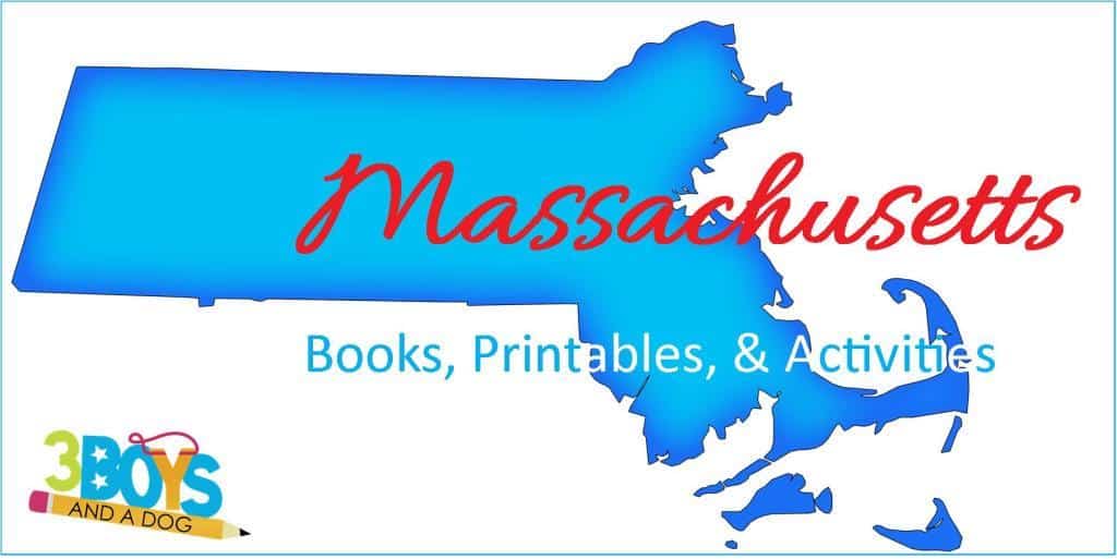
Massachusetts
The state of Massachusetts lies in the northeastern United States. It borders New Hampshire and Vermont to the north and New York to the west. Connecticut and Rhode Island lie to the south, and the Atlantic Ocean to the east. Boston is the largest city in Massachusetts, followed by Worcester.
Moreover, the state experiences a humid continental climate, with cold winters and warm summers. Furthermore, Massachusetts is known for its significant role in American history and its prestigious educational institutions, such as Harvard and MIT.
The state also boasts a rich cultural scene, including music, theater, literature, and cuisine.
Massachusetts’ diverse landscapes, from coastal beaches to mountainous regions, make it an ideal destination for outdoor recreation, including hiking, skiing, and sailing.
14 Pages: Massachusetts State Unit Study
Books about Massachusetts for Kids
Free State Fact File Worksheets
Interesting Facts about Massachusetts
Massachusetts Coloring and Handwriting Worksheets

Michigan
The state of Michigan lies in the Great Lakes region of the United States. It consists of two peninsulas, with the Upper Peninsula bordered by Wisconsin and the Lower Peninsula bordered by Indiana and Ohio. Both peninsulas are surrounded by four of the Great Lakes. Detroit is the largest city in Michigan, followed by Grand Rapids.
Moreover, the state experiences a humid continental climate, with cold winters and warm summers. Furthermore, Michigan is a major center for the automotive industry, with a robust economy that also includes manufacturing, agriculture, and tourism.
The state also boasts a rich cultural heritage, with influences from Native American, French, and English settlers.
Michigan’s extensive waterways and forests offer abundant opportunities for outdoor activities, such as boating, fishing, hiking, and skiing.
14 Pages: Michigan State Unit Study
Free State Fact File Worksheets
Interesting Facts about Michigan
Michigan Coloring and Handwriting Worksheets

Minnesota
The state of Minnesota lies in the Upper Midwest region of the United States. It borders Canada to the north and Iowa to the south. Wisconsin lies to the east, and North Dakota and South Dakota to the west. Minneapolis is the largest city in Minnesota, followed by Saint Paul, the state capital.
Moreover, the state has a continental climate, with cold winters and warm summers. Furthermore, Minnesota is known for its strong economy, which includes sectors such as healthcare, education, manufacturing, and technology.
The state also boasts a rich cultural and artistic scene, with numerous theaters, museums, and music venues.
Minnesota’s many lakes and parks provide excellent opportunities for outdoor recreation, including fishing, boating, hiking, and winter sports like ice fishing and skiing.
14 Pages: Minnesota State Unit Study
Books about Minnesota for Kids
Free State Fact File Worksheets
Interesting Facts about Minnesota
Minnesota Coloring and Handwriting Worksheets

Mississippi
The state of Mississippi lies in the southeastern United States. It borders Tennessee to the north and Alabama to the east. Louisiana and the Gulf of Mexico lie to the south, while Arkansas lies to the west. Jackson is the largest city in Mississippi, followed by Gulfport.
Moreover, the state has a humid subtropical climate, with hot, humid summers and mild winters. Furthermore, Mississippi’s economy includes agriculture, manufacturing, and service industries.
The state also boasts a rich cultural heritage, especially in music, literature, and cuisine.
Mississippi’s diverse landscape and climate make it an ideal destination for outdoor recreation. The state’s parks and rivers offer opportunities for hiking, fishing, and boating.
14 Pages: Mississippi State Unit Study
Books about Mississippi for Kids
Mississippi Crafts for Children
Free Mississippi State Fact File Worksheets
Interesting Facts about Mississippi
Mississippi Coloring and Handwriting Worksheets

Missouri
The state of Missouri lies in the Midwestern United States. It borders Iowa to the north and Arkansas to the south. Illinois, Kentucky, and Tennessee lie to the east, while Kansas, Nebraska, and Oklahoma lie to the west. Kansas City is the largest city in Missouri, followed by St. Louis.
Moreover, the state experiences a continental climate, with cold winters and hot, humid summers. Furthermore, Missouri’s economy includes agriculture, manufacturing, and services.
The state also boasts a rich cultural scene, including music, theater, and food.
Missouri’s diverse landscapes, including rivers and forests, provide excellent opportunities for outdoor activities such as hiking, boating, and fishing.
14 Pages: Missouri State Unit Study
Free Missouri State Fact File Worksheets
Interesting Facts about Missouri
Missouri Coloring and Handwriting Worksheets

Montana
The state of Montana lies in the northwestern United States. It borders Canada to the north, North Dakota and South Dakota to the east. Wyoming lies to the south, and Idaho to the west. Billings is the largest city in Montana, followed by Missoula.
Would you like to save this?
Moreover, the state experiences a varied climate, ranging from semi-arid in the eastern plains to alpine in the mountainous west. Furthermore, Montana’s economy includes agriculture, mining, and tourism.
The state also boasts a rich cultural heritage, with influences from Native American, European, and pioneer traditions.
Montana’s vast landscapes, including national parks and wilderness areas, make it an ideal destination for outdoor recreation. The state’s mountains and rivers offer opportunities for hiking, fishing, and skiing.
14 Pages: Montana State Unit Study
Montana Crafts for Children
Free Montana State Fact File Worksheets
Interesting Facts about Montana
Montana Coloring and Handwriting Worksheets

Nebraska
The state of Nebraska lies in the Midwestern United States. It borders South Dakota to the north and Kansas to the south. Iowa and Missouri lie to the east, while Colorado and Wyoming lie to the west. Omaha is the largest city in Nebraska, followed by Lincoln.
Moreover, the state experiences a continental climate, with cold winters and hot summers. Furthermore, Nebraska’s economy includes agriculture, manufacturing, and transportation.
The state also boasts a rich cultural heritage, with influences from Native American and pioneer traditions.
Nebraska’s diverse landscapes, including prairies and sandhills, provide excellent opportunities for outdoor activities such as hiking, birdwatching, and fishing.
14 Pages: Nebraska State Unit Study
Free Nebraska State Fact File Worksheets
Interesting Facts about Nebraska
Nebraska Coloring and Handwriting Worksheets

Nevada
The state of Nevada lies in the western United States. It borders Oregon and Idaho to the north and California to the west. Utah lies to the east, and Arizona to the southeast. Las Vegas is the largest city in Nevada, followed by Reno.
Moreover, the state has a semi-arid to arid climate, with hot summers and mild winters. Furthermore, Nevada’s economy includes tourism, mining, and gaming.
The state also boasts a vibrant cultural scene, particularly in entertainment and the arts.
Nevada’s unique landscapes, including deserts and mountain ranges, make it an ideal destination for outdoor recreation. The state’s parks and natural areas offer opportunities for hiking, camping, and off-road adventures.
14 Pages: Nevada State Unit Study
Nevada Crafts for Children
Free Nevada State Fact File Worksheets
Interesting Facts about Nevada
Nevada Coloring and Handwriting Worksheets

New Hampshire
Because of its position, it is bordered by Vermont to the west, Maine and the Atlantic Ocean to the east, Massachusetts to the south, and the Canadian province of Quebec to the north.
Additionally, Manchester is the largest city in New Hampshire, followed by Nashua.
The state experiences a humid continental climate, with warm summers and cold, snowy winters. Moreover, key industries include manufacturing, healthcare, tourism, and education.
Furthermore, it is celebrated for its historical significance, charming small towns, and strong traditions in arts and crafts.
The state’s picturesque landscapes, including the White Mountains, lakes, and coastal regions, provide ample opportunities for outdoor activities such as hiking, skiing, boating, and leaf-peeping during the fall.
14 Pages: New Hampshire State Unit Study
Books about New Hampshire for Kids
Free New Hampshire State Fact File Worksheets
Interesting Facts about New Hampshire
New Hampshire Coloring and Handwriting Worksheets

New Jersey
This is a state located in the northeastern United States. It is bordered by New York to the north, Pennsylvania to the west, Delaware to the southwest, and the Atlantic Ocean to the east.
Additionally, Newark is the largest city in New Jersey, while Jersey City follows as the second-largest.
The state has a diverse climate, ranging from humid subtropical in the south to more continental conditions in the north. The economy is driven by industries such as pharmaceuticals, finance, chemical development, telecommunications, and tourism.
Known for its rich history, cultural diversity, and vibrant arts scene, including significant contributions to music, theater, and literature. Moreover, the state’s varied landscapes, which include beaches, forests, and urban areas, make it ideal for a wide range of outdoor activities.
These activities range from hiking and fishing to beachgoing and exploring bustling cities.
14 Pages: New Jersey State Unit Study
Books about New Jersey for Kids
New Jersey Crafts for Children
Free New Jersey State Fact File Worksheets
Interesting Facts about New Jersey
New Jersey Coloring and Handwriting Worksheets

New Mexico
This state is located in the southwestern United States. It is bordered by Colorado to the north, Oklahoma and Texas to the east, Texas and the Mexican states of Chihuahua and Sonora to the south, and Arizona to the west. Additionally, Albuquerque is the largest city in this state, followed by Las Cruces.
The state has a varied climate, including arid and semi-arid conditions, with cooler temperatures in higher elevations. Moreover, major industries include oil and gas, aerospace and defense, tourism, and agriculture.
Furthermore, New Mexico is known for its unique cultural heritage, blending Native American, Hispanic, and Anglo influences, which is reflected in its art, cuisine, and festivals.
The state’s diverse landscapes, from deserts and mountains to forests and plateaus, offer numerous opportunities for outdoor recreation such as hiking, skiing, and exploring ancient ruins.
14 Pages: New Mexico State Unit Study
Books about New Mexico for Kids
New Mexico Crafts for Children
Free New Mexico State Fact File Worksheets
Interesting Facts about New Mexico
New Mexico Coloring and Handwriting Worksheets
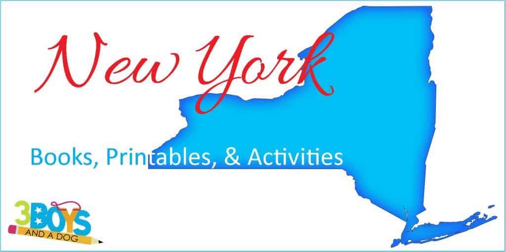
New York
This famous state is located in the northeastern United States. Because of its geographical position, it borders New Jersey and Pennsylvania to the south, Connecticut, Massachusetts, and Vermont to the east, and Canada to the north and west. Certainly, New York City is the largest city, followed by Buffalo.
Although the state has a diverse climate, humid continental conditions dominate the interior, while a more humid subtropical climate prevails in the southeastern part, including New York City. Key industries include finance, media, technology, healthcare, and tourism.
New York is renowned for its cultural influence, with world-class museums, theaters, and music venues, as well as being a global center for business and innovation.
The state’s geography ranges from the skyscrapers of Manhattan to the stunning natural beauty of the Adirondacks, offering endless opportunities for urban exploration and outdoor adventures.
14 Pages: New York State Unit Study
Books about New York for Kids
Free New York State Fact File Worksheets
Statue of Liberty Craft Ideas for Early Learners
Interesting Facts About New York
New York Coloring and Handwriting Book
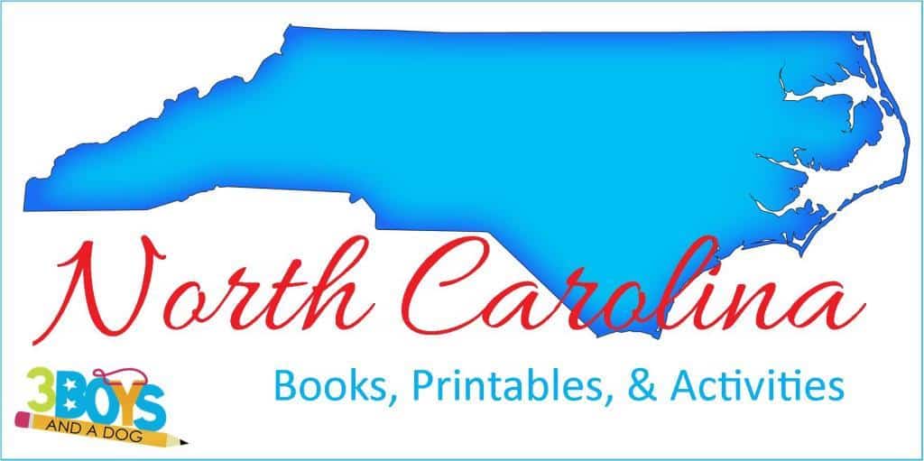
North Carolina
The state of North Carolina lies in the southeastern United States. It borders Virginia to the north and South Carolina to the south. Tennessee lies to the west, while the Atlantic Ocean lies to the east. Charlotte is the largest city in North Carolina, followed by Raleigh.
Moreover, the state has a varied climate, ranging from humid subtropical in the coastal plain to continental in the mountains. Furthermore, North Carolina’s economy includes agriculture, manufacturing, technology, and finance.
The state also boasts a rich cultural heritage, including music, art, and cuisine.
North Carolina’s diverse landscapes, from the Appalachian Mountains to the Outer Banks, make it an ideal destination for outdoor recreation. The state’s parks and beaches offer opportunities for hiking, camping, and fishing.
14 Pages: North Carolina State Unit Study
Books about North Carolina for Kids
North Carolina Crafts for Children
Free North Carolina State Fact File Worksheets
Interesting Facts About North Carolina
North Carolina Coloring and Handwriting Book

North Dakota
The state of North Dakota lies in the Upper Midwest region of the United States. It borders Canada to the north and South Dakota to the south. Montana lies to the west, while Minnesota lies to the east. Fargo is the largest city in North Dakota, followed by Bismarck, the state capital.
Moreover, the state experiences a continental climate, with cold winters and warm summers. Furthermore, North Dakota’s economy includes agriculture, oil production, and energy.
The state also boasts a rich cultural heritage, with influences from Native American and European settlers.
North Dakota’s wide-open spaces and natural beauty provide excellent opportunities for outdoor activities such as hiking, fishing, and hunting.
14 Pages: North Dakota State Unit Study
North Dakota Crafts for Children
Free North Dakota State Fact File Worksheets
Interesting Facts About North Dakota
North Dakota Coloring and Handwriting Book

Ohio
This state is located in the Midwestern region of the United States. Because of its geographical position, it is bordered by Michigan to the north, Pennsylvania to the east, West Virginia to the southeast, Kentucky to the south, and Indiana to the west. Certainly, Columbus is the largest city in Ohio, followed by Cleveland and Cincinnati.
Ohio has a humid continental climate, resulting in cold winters and warm, humid summers. The state’s major industries include manufacturing, finance, healthcare, agriculture, and technology.
Moreover, Ohio is renowned for its cultural institutions, including museums, theaters, and music venues, as well as its contributions to sports and aviation history.
Finally, the state’s diverse landscape, featuring rolling hills, forests, and numerous rivers and lakes, makes it an ideal location for outdoor recreation. Ohio’s parks and natural areas offer activities such as hiking, boating, fishing, and camping.
14 Pages: Ohio State Unit Study
Free Ohio State Fact File Worksheets
Ohio Coloring and Handwriting Book

Oklahoma
This is a state located in the South Central region of the United States. Because of its location, it is bordered by Kansas to the north, Missouri to the northeast, Arkansas to the east, Texas to the south and west, and New Mexico to the west. Certainly, Oklahoma City is the largest city in Oklahoma, followed by Tulsa.
Additionally, the state has a varied climate, with humid subtropical conditions in the east and semi-arid conditions in the west. Oklahoma’s key industries include energy, agriculture, aviation, biotechnology, and telecommunications.
Oklahoma is also known for its significant Native American history and culture, with 39 tribes headquartered in the state. The state offers a rich blend of cultural experiences, including music, art, and festivals.
With its diverse landscapes ranging from plains to hills and lakes, Oklahoma provides ample opportunities for outdoor activities such as hiking, fishing, boating, and exploring state parks.
14 Pages: Oklahoma State Unit Study
Free Oklahoma State Fact File Worksheets
Oklahoma Coloring and Handwriting Book

Oregon
The state of Oregon lies in the Pacific Northwest region of the United States. It borders Washington to the north and California to the south. Idaho lies to the east, while the Pacific Ocean lies to the west. Portland is the largest city in Oregon, followed by Salem, the state capital.
Moreover, the state has a varied climate, with a mild, wet coastal climate and drier conditions inland. Furthermore, Oregon’s economy includes technology, agriculture, and tourism.
The state also boasts a rich cultural scene, including music, literature, and cuisine.
Oregon’s diverse landscapes, including forests, mountains, and coastline, make it an ideal destination for outdoor recreation. The state’s parks and trails offer opportunities for hiking, camping, and fishing.
14 Pages: Oregon State Unit Study
Books about Oregon for Kids
Oregon Crafts for Children
Free Oregon State Fact File Worksheets
Interesting Facts about Oregon
Oregon Coloring and Handwriting Book

Pennsylvania
Pennsylvania is a state located in the northeastern United States. Specifically, it is bordered by New York to the north, New Jersey to the east, Delaware and Maryland to the south, and West Virginia and Ohio to the west. Additionally, Philadelphia is the largest city in Pennsylvania, followed by Pittsburgh.
Moreover, the state has a humid continental climate, with warm summers and cold winters. Furthermore, Pennsylvania’s economy is diverse, featuring industries such as manufacturing, agriculture, energy production, and healthcare.
The state is also known for its rich cultural heritage, which includes historical landmarks, art, literature, and cuisine.
Pennsylvania’s varied landscape, including mountains, forests, and rivers, makes it an ideal location for outdoor activities. The state’s parks and natural areas offer opportunities for hiking, camping, fishing, and boating.
14 Pages: Pennsylvania State Unit Study
Books about Pennsylvania (for Children)
Free State Fact File Worksheets
Pennsylvania Crafts for Children
Pennsylvania Handwriting and Coloring Worksheets

Rhode Island
Rhode Island is a state located in the northeastern United States. Specifically, it is bordered by Massachusetts to the north and east, Connecticut to the west, and the Atlantic Ocean to the south. Additionally, Providence is the largest city and capital of Rhode Island.
Moreover, the state has a humid continental climate, with warm summers and cold winters. Furthermore, Rhode Island’s economy includes key sectors such as healthcare, education, manufacturing, and tourism.
The state is also celebrated for its rich cultural heritage, which includes historic sites, art, music, and cuisine.
Rhode Island’s coastal landscape, featuring beaches and bays, makes it an ideal destination for outdoor recreation. The state’s parks and seaside areas provide opportunities for swimming, sailing, fishing, and more.
14 Pages: Rhode Island State Unit Study
Books about Rhode Island for Kids
Rhode Island Crafts for Children
Free Rhode Island State Fact File Worksheets
Rhode Island Coloring and Handwriting Book
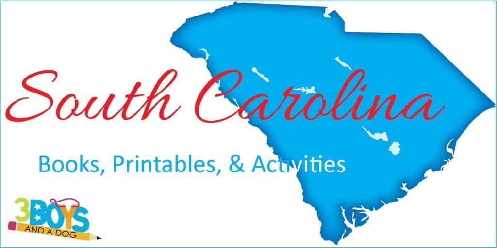
South Carolina
South Carolina is a state located in the southeastern United States. Specifically, it is bordered by North Carolina to the north, Georgia to the southwest, and the Atlantic Ocean to the southeast. Additionally, Charleston is the largest city in South Carolina, followed by Columbia.
Moreover, the state has a humid subtropical climate, with hot, humid summers and mild winters. Furthermore, South Carolina’s economy is driven by industries such as manufacturing, agriculture, tourism, and aerospace.
The state is also known for its rich cultural heritage, which includes music, literature, art, and cuisine.
South Carolina’s diverse landscape, including beaches, mountains, and forests, makes it an ideal location for outdoor activities. The state’s parks and recreational areas offer opportunities for hiking, camping, fishing, and exploring historical sites.
14 Pages: South Carolina State Unit Study
Books about South Carolina for Kids
Free State Fact File Worksheets
South Carolina Crafts for Kids
Interesting Facts about South Carolina
South Carolina Coloring and Handwriting Book

South Dakota
The state of South Dakota lies in the Upper Midwest region of the United States. It borders North Dakota to the north and Nebraska to the south. Minnesota and Iowa lie to the east, while Wyoming and Montana lie to the west. Sioux Falls is the largest city in South Dakota, followed by Rapid City.
Moreover, the state experiences a continental climate, with cold winters and warm summers. Furthermore, South Dakota’s economy includes agriculture, tourism, and manufacturing.
The state also boasts a rich cultural heritage, with historic landmarks and Native American traditions.
South Dakota’s unique landscapes, including the Black Hills and Badlands, make it an ideal destination for outdoor activities such as hiking, camping, and sightseeing.
14 Pages: South Dakota State Unit Study
Books about South Dakota for Kids
Free State Fact File Worksheets
Some Interesting Facts about South Dakota
South Dakota Coloring and Handwriting Book

Tennessee
The state of Tennessee lies in the southeastern United States. It borders Kentucky and Virginia to the north and Georgia, Alabama, and Mississippi to the south. North Carolina lies to the east, while Arkansas and Missouri lie to the west. Nashville is the largest city in Tennessee, followed by Memphis.
Moreover, the state has a varied climate, with hot, humid summers and mild winters. Furthermore, Tennessee’s economy includes music, healthcare, manufacturing, and agriculture.
The state also boasts a rich cultural heritage, especially in music, with significant contributions to country, blues, and rock ‘n’ roll.
Tennessee’s diverse landscapes, from the Great Smoky Mountains to the Mississippi River, make it an ideal destination for outdoor recreation. The state’s parks and trails offer opportunities for hiking, fishing, and boating.
14 Pages: Tennessee State Unit Study
Books about Tennessee for Kids
Free Tennessee State Fact File Worksheets
Tennessee Handwriting and Coloring Pages for Learning Fun
Interesting Facts about Tennessee

Texas
The state of Texas lies in the southern United States. It borders Oklahoma to the north and Louisiana and Arkansas to the east. New Mexico lies to the west, while Mexico and the Gulf of Mexico lie to the south. Houston is the largest city in Texas, followed by San Antonio.
Moreover, the state has a varied climate, ranging from arid deserts in the west to humid subtropical in the east. Furthermore, Texas’s economy includes energy, technology, agriculture, and manufacturing.
The state also boasts a rich cultural heritage, with influences from Native American, Mexican, and Southern traditions.
Texas’s vast landscapes, including deserts, plains, and coastlines, make it an ideal destination for outdoor activities. The state’s parks and natural areas offer opportunities for hiking, fishing, and camping.
14 Pages: Texas State Unit Study
Free Texas State Fact File Worksheets
Interesting Facts about the state of Texas
Texas Coloring and Handwriting Book

Utah
The state of Utah lies in the western United States. It borders Idaho and Wyoming to the north and Colorado to the east. Arizona lies to the south, while Nevada lies to the west. Salt Lake City is the largest city in Utah, followed by West Valley City.
Moreover, the state experiences a semi-arid to desert climate, with hot summers and cold winters. Furthermore, Utah’s economy includes tourism, mining, and technology.
The state also boasts a rich cultural heritage, influenced by Native American and Mormon traditions.
Utah’s diverse landscapes, including national parks and mountain ranges, make it an ideal destination for outdoor activities. The state’s parks offer opportunities for hiking, skiing, and rock climbing.
14 Pages: Utah State Unit Study
Free Utah State Fact File Worksheets
Utah Coloring and Handwriting Book

Vermont
The state of Vermont lies in the northeastern United States. It borders Canada to the north and New Hampshire to the east. Massachusetts lies to the south, while New York lies to the west. Burlington is the largest city in Vermont, followed by South Burlington.
Moreover, the state experiences a humid continental climate, with cold winters and warm summers. Furthermore, Vermont’s economy includes agriculture, tourism, and manufacturing.
The state also boasts a rich cultural heritage, with influences from Native American and European settlers.
Vermont’s scenic landscapes, including mountains and forests, provide excellent opportunities for outdoor recreation. The state’s parks and trails offer opportunities for hiking, skiing, and fishing.
14 Pages: Vermont State Unit Study
Vermont State Fact File Worksheets
Vermont Coloring and Writing Book

Virginia
The state of Virginia lies in the southeastern United States. It borders Maryland and Washington, D.C. to the north and North Carolina and Tennessee to the south. West Virginia and Kentucky lie to the west, while the Atlantic Ocean lies to the east. Virginia Beach is the largest city in Virginia, followed by Norfolk.
Moreover, the state has a varied climate, ranging from humid subtropical in the east to continental in the mountains. Furthermore, Virginia’s economy includes government services, technology, and agriculture.
The state also boasts a rich cultural heritage, with significant contributions to American history and culture.
Virginia’s diverse landscapes, from coastal beaches to mountain ranges, make it an ideal destination for outdoor recreation. The state’s parks and historic sites offer opportunities for hiking, fishing, and sightseeing.
14 Pages: Virginia State Unit Study
Free Virginia State Fact File Worksheets
Virginia Coloring and Handwriting Book

Washington
The state of Washington lies in the Pacific Northwest region of the United States. It borders Canada to the north and Oregon to the south. Idaho lies to the east, while the Pacific Ocean lies to the west. Seattle is the largest city in Washington, followed by Spokane.
Moreover, the state has a varied climate, with a wet coastal climate and drier conditions inland. Furthermore, Washington’s economy includes technology, aerospace, and agriculture.
The state also boasts a rich cultural scene, including music, literature, and cuisine.
Washington’s diverse landscapes, including forests, mountains, and coastline, make it an ideal destination for outdoor recreation. The state’s parks and trails offer opportunities for hiking, camping, and fishing.
14 Pages: Washington State Unit Study
Washington Crafts for Children
Free Washington State Fact File Worksheets
Washington Coloring and Handwriting Book

West Virginia
The state of West Virginia lies in the Appalachian region of the United States. It borders Pennsylvania and Maryland to the north and Virginia to the east. Kentucky lies to the southwest, while Ohio lies to the northwest. Charleston is the largest city in West Virginia, followed by Huntington.
Moreover, the state experiences a humid subtropical climate, with warm summers and mild winters. Furthermore, West Virginia’s economy includes energy, manufacturing, and tourism.
The state also boasts a rich cultural heritage, with influences from Native American and European settlers.
West Virginia’s mountainous landscapes and rivers provide excellent opportunities for outdoor activities such as hiking, fishing, and white-water rafting.
14 Pages: West Virginia State Unit Study
Books about West Virginia for Kids
Free West Virginia State Fact File Worksheets
West Virginia Activities for Kids
West Virginia Coloring and Handwriting Book

Wisconsin
The state of Wisconsin lies in the Midwestern United States. It borders Minnesota to the west and Iowa to the south. Illinois lies to the south, while Michigan and Lake Michigan lie to the east. Milwaukee is the largest city in Wisconsin, followed by Madison, the state capital.
Moreover, the state experiences a humid continental climate, with cold winters and warm summers. Furthermore, Wisconsin’s economy includes agriculture, manufacturing, and healthcare.
The state also boasts a rich cultural heritage, with influences from Native American and European settlers.
Wisconsin’s diverse landscapes, including lakes and forests, provide excellent opportunities for outdoor recreation. The state’s parks and waterways offer opportunities for hiking, fishing, and boating.
14 Pages: Wisconsin State Unit Study
Books about Wisconsin for Kids
Wisconsin Crafts for Children
Wisconsin State Fact File Worksheets
Wisconsin Coloring and Handwriting Book

Wyoming
The state of Wyoming lies in the western United States and it borders Montana to the north and South Dakota and Nebraska to the east. Colorado lies to the south, while Utah and Idaho lie to the west. Cheyenne is the largest city in Wyoming, followed by Casper.
Moreover, the state experiences a semi-arid to continental climate, with cold winters and warm summers. Furthermore, Wyoming’s economy includes energy, agriculture, and tourism.
The state also boasts a rich cultural heritage, with influences from Native American and cowboy traditions.
Wyoming’s vast landscapes, including national parks and mountain ranges, make it an ideal destination for outdoor activities. Additionally, the state’s parks and wilderness areas offer opportunities for hiking, fishing, and wildlife viewing.
14 Pages: Wyoming State Unit Study
Books about Wyoming for Kids
Wyoming State Fact File Worksheets
Wyoming Coloring and Handwriting Book
State Flags
State flags are an essential part of each state’s identity, representing their unique history, culture, and values. Therefore, in our study guides, you will find coloring pages of the state flags. This feature allows students to familiarize themselves with these important symbols while engaging in a creative activity.
History buffs may find it particularly fascinating to dive into the rich narratives behind each state’s flag.
From the simple design of Delaware’s flag, featuring a single gold diamond on a field of colonial blue, to the intricate details of New Mexico’s flag, incorporating elements of both Spanish and Native American culture, state flags offer a glimpse into the stories and values that shape each state.
Using Flags in State Studies
Engaging students in flag-related activities can foster a deeper understanding of state pride and symbolism. For example, you can encourage students to research the history behind each state flag, exploring the meaning behind the colors, symbols, and mottoes. They can also compare and contrast the designs of different state flags, noting similarities and differences.
By incorporating flag-related activities into your lesson plans, you can not only help students develop visual literacy skills but also cultivate a sense of pride and appreciation for the diverse tapestry of the United States.
Lesson Plans and Study Guides
Our lesson plans and study guides cater to all age groups and difficulty levels. Therefore, they assist teachers and homeschoolers in planning state unit studies.
Additionally, these resources offer step-by-step instructions, activities, and reading materials, allowing educators to teach about the U.S. in engaging and effective ways.
Our United States Lapbooks provide interactive and hands-on activities for students to explore state symbols, historical events, and exciting facts. Furthermore, students can create mini-books and engage in research projects to deepen their understanding of each state’s history and culture.
States Quizzes and Games
Whether you focus on state names, capitals, national parks, or other important facts, these resources are valuable additions to your teaching toolkit.
Coloring Pages and Focus Pages
For younger students or those who prefer hands-on activities, coloring pages and focus pages are a great resource to learn about the 50 states. Consequently, these printable resources provide an engaging and fun way for students to explore state shapes, symbols, and more.
They can also serve as handy references while studying.
Coloring pages feature a state’s outline and name. Students can color in the state and its symbols, such as birds, flowers, flags, or landmarks, to become familiar with each state and visually connect with its unique characteristics.
Focus pages, on the other hand, provide a more focused study of a specific state. These pages often include information about the state’s geography, history, culture, and notable landmarks. They may also feature blank maps for students to label and identify important cities, capital cities, or geographical features within the state.
Both coloring pages and focus pages can be used independently or in conjunction with other resources like the “USA State Guide.” For example, students can color a state’s flag while learning about its historical significance or study the state’s shape while exploring its unique geography and natural features.
State Symbols and Official Facts
State symbols offer insights into the history and culture of each state. For example, the Grand Canyon in Arizona symbolizes natural wonder, while cities like New York City and Los Angeles represent hubs of culture and innovation.
Additionally, this study guide includes a curated list of online resources and interactive tools that complement your teaching.
Let’s take a closer look at a couple of fun state facts and their official symbols:
New Hampshire State Symbols:
Known as the “Granite State,” New Hampshire boasts the purple finch as its state bird. This vibrant bird adds a pop of color to the New England landscape. The state’s official flower is the purple lilac, which not only represents beauty but also symbolizes hardiness and determination.
Rhode Island State Symbols:
Despite its small size, Rhode Island has some interesting official symbols. The Rhode Island Red chicken proudly serves as its state bird, while the violet represents the state flower. These symbols reflect the state’s agricultural heritage and natural beauty.
Additional Activities for Various Grade Levels
Here are some additional activities to make your state unit study even more engaging:
2nd Grade: To begin with, provide students with coloring pages of the United States map and have them color each state based on its assigned color.
3rd Grade: Create flashcards with state names on one side and fun facts about each state on the other side.
4th Grade: Assign each student a different state and have them research its history, geography, and notable landmarks.
5th Grade: Furthermore, provide students with a worksheet where they match each state with its corresponding capital city.
Frequently Asked Questions About Studying the 50 States
Have questions about effectively teaching and learning all 50 states? Here are some answers to common inquiries.
Remember, adapting activities to suit different grade levels and learning styles is key. Feel free to modify these suggestions to meet the needs of your students.

Teaching the 50 states can be an exciting and educational journey for both teachers and students.
Indeed, with the resources and activities provided in this study guide, you can make the learning experience interactive, engaging, and fun.
Because of the diverse materials included, whether you’re focusing on state facts, maps, symbols, or history, there’s something here for everyone. Happy state studying!